Wearable Sensor System Creates Digital Maps In Real-Time

Building on previous research lending robots the ability to map their environments simply by manoeuvring itself around a building autonomously, MIT researchers have now built a portable, wearable sensor system that automatically creates a digital map in real-time using data collected from the wearer’s every move.
With what might prove invaluable in aiding relief efforts or a tool to help emergency responders co-ordinate movement around a disaster zone; the sensor system accounts for changes in altitude (important when moving from floor to floor, obviously), provides accurate data on distance travelled and even has the capability of allowing the wearer to ‘annotate’ the map by pressing a button on the device, signalling a particular point of interest. It is hoped further development may allow users to add voice or text tags to the map also, signalling potential threats or otherwise relaying geographic information to other teams.
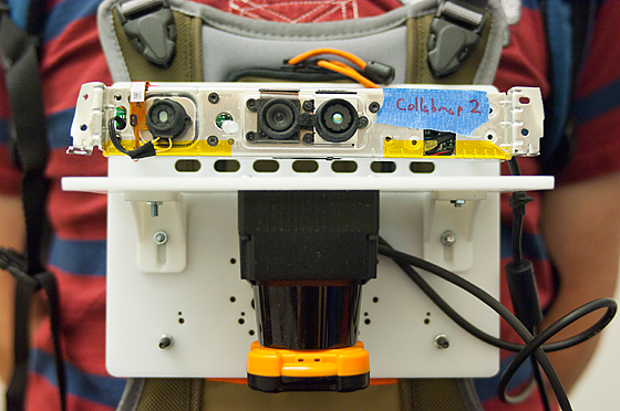
 The prototype sensor system consists of a variety of devices attached to a sheet of hard plastic reportedly the “size of an iPad” (Science Daily), which is worn on the chest. Amongst them is a laser range-finder that shoots a laser beam around a 270-degree arc and then measures the time it takes for light pulses to return, where an approximate location and distance of the nearest walls can be calculated. Numerous accelerometers and gyroscopes are used to identify the direction, tilt and altitude of the pack, while a camera affixed to the wearer takes snapshots of the wearers’ surroundings every few meters travelled.
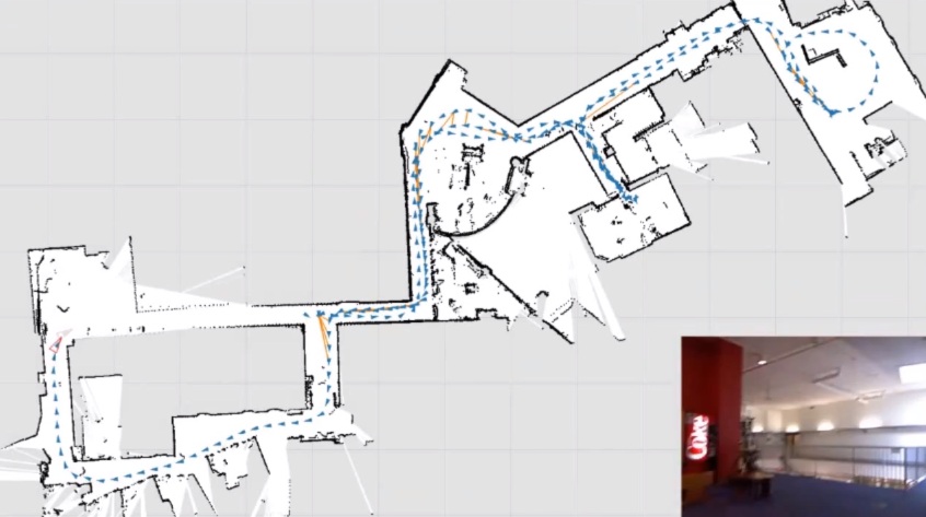
What’s left is a digitised 2D map with accurate architectural readings, annotations signalling points of interest and a quantity of photographs to give responders a better impression of what they’re facing, possibly further aiding relief efforts. It wouldn't be a stretch to believe real-time 3D mapping is just around the corner also, potentially taking us one step closer to the likes of Prometheus' flying mapping drones. But until then, MIT has us covered.
Source: Science Daily
Image Credit: MIT News Office, Patrick Gillooly
Richard Birkett

